Update 9:50 AM 10/11/21
- Size: 968.17 acres
- Containment is 100% as of 3:00 p.m. on 10/10/21.
- The fire remains active within the fire perimeter with interior smoke and occasional hot spots.
- The public can expect to see occasional smoke continuing in the coming days.
- Firefighters remain on scene to monitor fireline and to extinguish hot spots.
Update 1:40 PM 10/8/21
- Containment and acreage remains the same.
- Firefighters will continue mop up efforts to extinguish remaining hot spots near the containment line. Rehab efforts are also ongoing to include fixing and seeding dozer lines, fixing fences that were cut during firefighting operations, and fixing roads and trails that firefighting equipment may have damaged.
- Residents should expect to see smoke coming from within the fire perimeter.
- No further updates will be posted unless there is significant news.
Update 1:00 PM 10/7/21
- Due to accurate mapping, the size is 968.17 acres
- Containment is now 70%
Update 8:15 AM 10/7/21
- Today firefighters will diligently continue with extensive mop up and rehab operations.
- Winds are expected to increase today and become more northwesterly. Elevated fire conditions will continue today, with northerly winds up to 15 mph in the afternoon, and a minimum relative humidity approaching 25%. The outlook for Friday is increasing moisture and lighter winds. Chances for rain increase Friday night into Saturday.
- Residents near the fire area should expect to continue to see smoke that is coming from fuel burning within the fire perimeter.
Update 7:00 PM 10/6/21
- Today firefighters focused on an extensive mop up operation to reinforce containment lines. No spot fires emerged, containment lines held through the hot, dry, and windy Red Flag conditions.
- Residents near the fire area should expect to continue to see smoke that is coming from fuel burning within the fire perimeter.
- Tonight will be the last night operational shift unless fire conditions change considerably.
- A rehab plan for the fire area is in place which includes rehabing and seeding dozer lines, fixing fences that were cut during firefighting operations, and fixing roads and trails that firefighting equipment may have damaged.
- This will be the final update for the evening unless significant fire activity occurs.
Update 4:15 PM 10/6/21
State
Wildland Fire, the Rapid City Fire Department and Rapid City Police Department
have determined the cause of the Auburn Fire as accidental, due to mechanical
failure of earth moving equipment. This was not a human caused fire. The earth
moving equipment had been sitting in a field and had not been operated for a
long period of time. There is evidence to confirm these findings. The fire
started on private property within city limits and quickly spread outside of
the city. No additional information will be available.
Update 12:45 PM 10/6/21
- The south easterly winds are causing some flare ups within the fire perimeter and some visual smoke. Firefighters continue to extinguish hot spots and reinforce containment lines. Dozer line repair has also begun.
- Air Attack flew over the fire and reported that there are no spots outside of the fireline.
- Pockets of unburned fuel within the fire perimeter continue to burn. The public should expect to continue to see smoke and during evening hours, an orange glow and possibly flames.
Update 8:00 AM 10/6/21
- The acreage is estimated at 974 acres, containment remains at 50%.
- A small burn out operation was accomplished overnight on the southern portion of the fire to eliminate fuels and strengthen fireline.
- Fire behavior was active overnight as fire crews assisted volunteer and municipal crews with two new starts outside of the fire area to the north. One fire was reported to be estimated at 10 acres, the other roughly 35 acres.
- Today there is a Red Flag Warning in effect from 11:00 AM to 7:00 PM this evening for gusty winds and low relative humidity. The hot, dry, and windy conditions will be a concern for firefighters.
- Firefighters will continue to aggressively secure fireline by reinforcing containment lines and mopping up hotspots. Aircraft will continue to be available to the Auburn Fire and for initial attack.
Update 6:00 PM 10/5/21
- Containment is now at 50%. Acreage remains the same at 964.
- Today firefighters secured fireline using burn out operations and continued the mop up effort. A large slash pile ignited within the fire perimeter, firefighters suppressed this area with resources from the ground and in the air to include an Air Attack plane, a Type 1 helicopter, and a Large Air Tanker (LAT).
- Tonight firefighters will continue with an overnight operational shift. Fire crews will maintain a presence in the area and monitor structures near the fire, reinforce containment lines, and extinguish hot spots.
- This will be the last update for this evening unless there is significant fire activity.
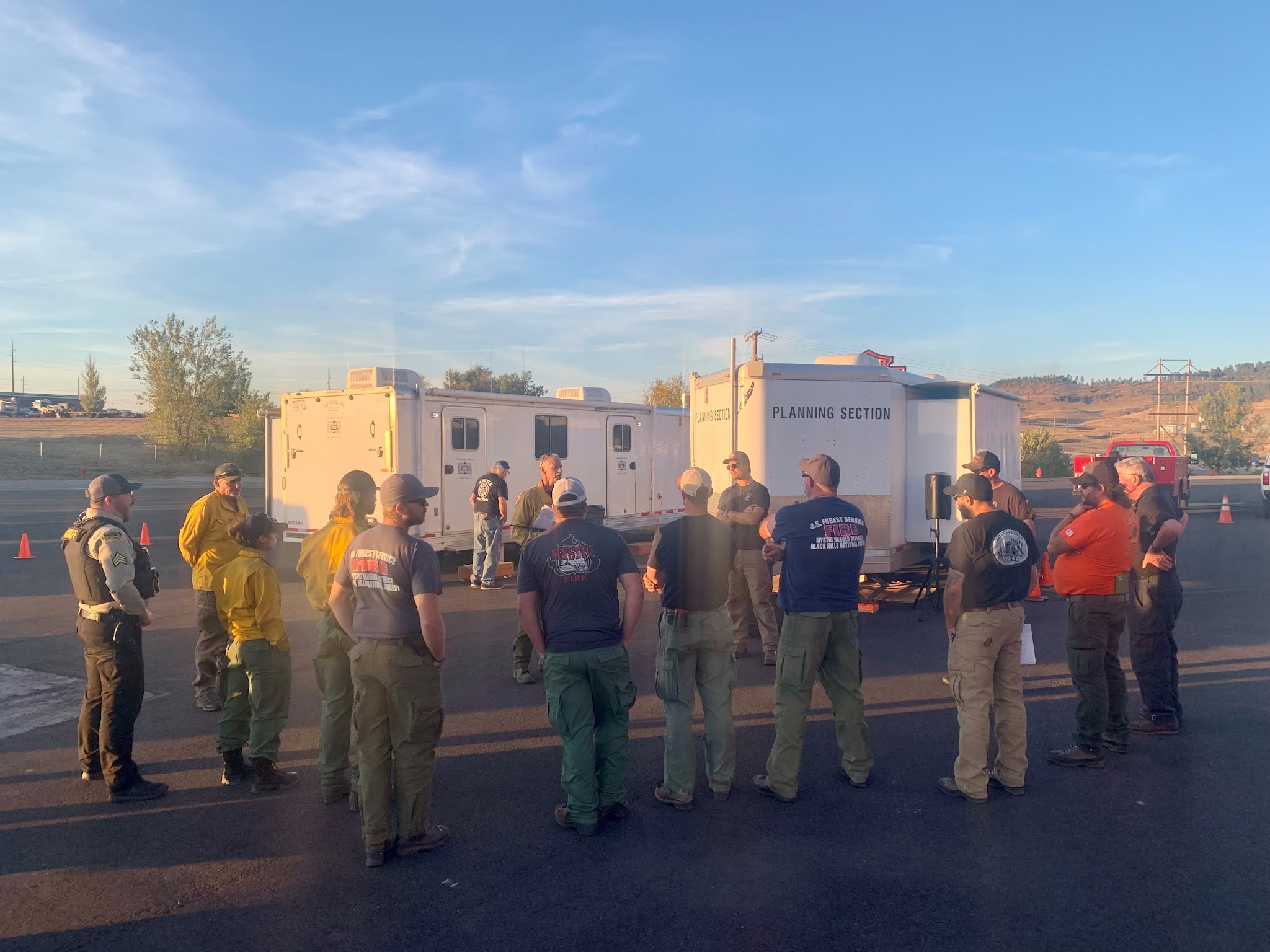 |
| Night Operational Briefing for the Auburn Fire. |
Update from the Pennington County Sheriff's Office
All fire evacuations, pre-evacuations, and road closures will be lifted at 6:00 PM. Only local residents will be allowed in the area so as not to hamper firefighters.
Update 2:00 PM 10/5/21
 |
| Map of the Auburn Fire with the updated perimeter from the Multi-Mission Aircraft flight. |
Update 1:30 PM 10/5/21
- A slash pile has ignited within the fire perimeter. Firefighters are currently using ground resources along with the Type 1 helicopter to lesson the intensity and extinguish the burn.

Update 12:40 PM 10/5/21
- A Multi-Mission Aircraft (MMA) flew the fire to provide an accurate fire perimeter and updated acreage. The current size is 964 acres.
- The southern portion of the fire is now in mop up and patrol status. Firefighters continue to extinguish hot spots to secure fireline.
- A small burnout operation took place in the northern and western portions of the fire to continue to secure fireline. The winds continue to come out of the south/south east and challenge firefighters. Fire managers continue to shift resources around appropriately to work to secure line. A Type 1 helicopter continues to work hot spots on the western portion of the fire.
Photo Upload from Previous Operational Periods
 |
| Engines at the Incident Command Post. |
 |
| Photo credit: Riley Stevens, SD Wildland Fire |
 |
| Photo credit: Riley Stevens, SD Wildland Fire |
 |
| Photo credit: Silver City VFD |
Update 9:50 AM 10/5/21
- Small burn out operations are taking place on the west and east portions of the fire to strengthen fireline. The public should continue to expect to see smoke in the area.
- A Type 1 helicopter and an Air Attack platform are enroute to do some bucket work on the west portion of the fire. This will aid in cooling hot spots near the fire perimeter.
Update 8:00 AM 10/5/21
- The acreage is now estimated at 500-750 acres.
- Containment has increased to 25%.
Update 7:45 AM 10/5/21
- Overnight, firefighters successfully conducted a burn out operation on the west and north portions of the fire. This burn out operation has greatly assisted to secure fireline in those areas and to provide for the defense of structures.
- Firefighters have now secured line around the entire fire perimeter and will continue to strengthen the containment lines throughout the day.
- Unburned pockets of fuel continue to ignite within the fire perimeter. The public can expect to see ignitions of that fuel throughout the day.
- The plan for today is to continue to utilize direct and indirect attack tactics to secure the fire's edge.
- The use of aircraft will continue throughout the day. An Air Attack platform will continue to be used as well as a Large Air Tanker, Single Engine Air Tankers, and a Type 1 helicopter. A Temporary Flight Restriction is in place. The use of unmanned aircraft (AKA drones) could shut down the entire air operation.
- Evacuations remain in effect. The public can view an interactive evacuation map at: https://www.pennco.org/publicsafetyhub or contact the Meade County Sheriff's Office at 605.347.2681.
Update 10:50 PM 10/04/21
- Firefighters are taking advantage of current conditions and are conducting a burn out operation near Deadwood Avenue on the west portion of the fire. This will assist in slowing and stopping the spread to the west and increasing containment lines. The public can expect to see an orange "glow" and increased smoke in the area.
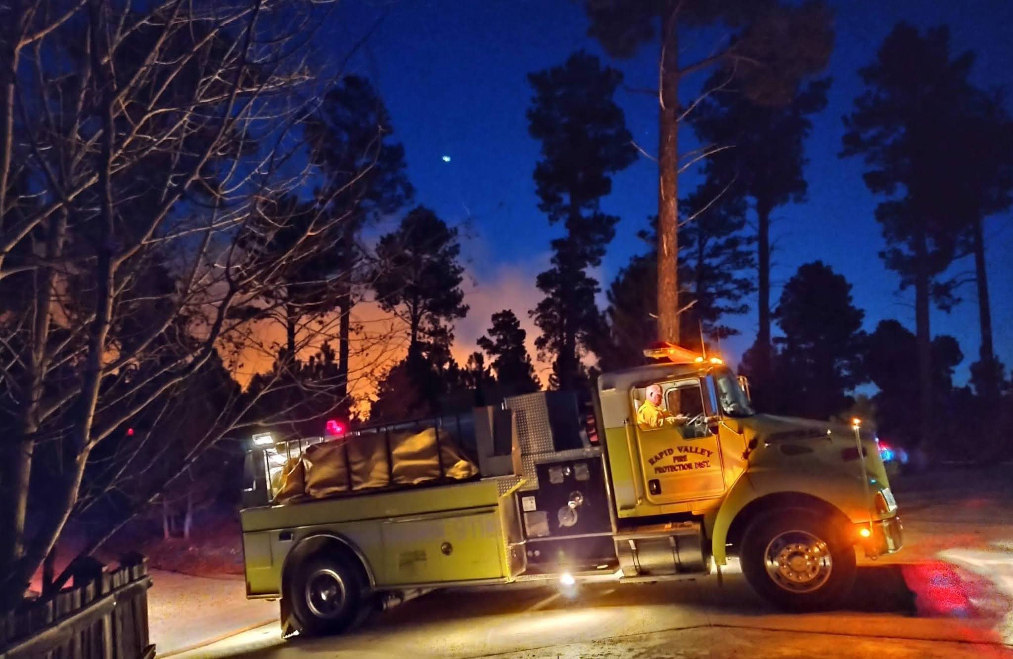 |
| Photo credit: Dawson Hoffman, Rapid Valley Fire Department |
Update 8:45 PM 10/4/21
- Firefighters will continue with a night operational shift. The objective is to continue to construct and strengthen direct and indirect containment lines and maintain a presence near structures.
- The Rapid City Air Tanker Base has been reopened and the Large Air Tanker will be available for use tomorrow morning, as well as the other aircraft previously listed.
- Near critical fire weather conditions are expected through Wednesday. Temperatures will continue in the upper 80s or even lower 90s. The minimum relative humidity will fall into the 7-20% range. Winds are expected to be out of the south at 10-20 mph with varied gusts.
- This will be the last update for tonight unless significant fire activity occurs. Another update will be posted in the morning after we receive an operational update.
- A Large Air Tanker (LAT) has arrived and is currently dropping retardant over the fire.
Update 6:15 PM 10/4/21
- Firefighter and public safety is the top priority.
- Single Engine Air Tankers (SEATs) are currently dropping retardant on the north and west flanks of the fire. An air attack platform is enroute. A Type 1 helicopter is preforming bucket work. The Rapid City Air Tanker Base is being reopened to supply water and retardant.
- The estimated size is now 250-300 acres and is 0% contained.
- Resources on scene include state, federal, and local firefighters. Heavy equipment is also being utilized.
- On the north and east sides of the fire, firefighters are going as direct as possible to install containment lines.
- On the west side of the fire, firefighters are scouting the area, looking for control features that will provide for the highest probability of success.
- On the south side, firefighters are holding, patrolling, and mopping up.
- No structures are known to be lost.
- Evacuations are in effect. An updated interactive evacuation map can be found at: https://www.pennco.org/publicsafetyhub
WILDFIRE UPDATE - new information @ 4:45 p.m. 10/4/2021
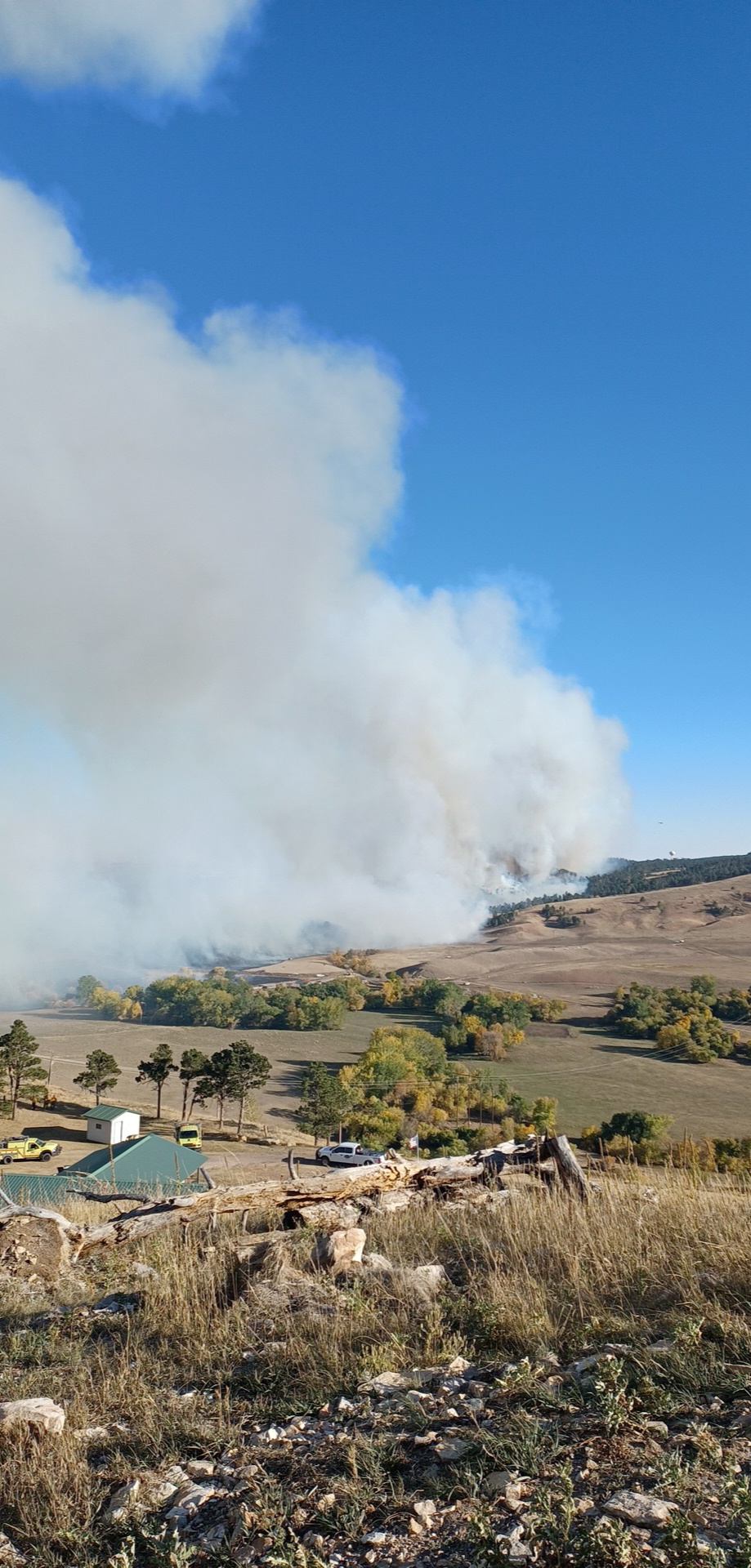
Auburn Fire
- Reported at 1:49 p.m. on 10/4/2021
- Location: approx. 4 miles North of Rapid City in Pennington County, South Dakota
- Size: 100 acres
- Cause: unknown
- Federal and State firefighters are responding. A single-engine air tanker (SEAT) and hFireeavy helicopters are providing air attack.
- For safety and evacuation information, visit https://www.pennco.org/publicsafetyhub