Tuesday, September 20, 2016

September 19, 2016

Falling Rock Campfire
  • Reported: 11:33 pm
  • Location: Pennington County, near Falling Rock, on Black Hills National Forest
  • Size:  0.10 acres
  • Federal and VFD resources responded 
  • Controlled

Sunday, September 18, 2016

Update: September 18, 2016

Incident #1 - Soy Bean CA Wildfire

  • Reported: 1:50 pm
  • Location: Stanley County; 10 miles NW of Ft Pierre.
  • Size:  11.6 acres
  • Resources responded. Controlled.
  • Cause: equipment


Incident #2 - First Thunder Wildfire

  • Reported: 2:51 pm
  • Location: 2 miles off Sheridan Lake Road on Victoria Lake Rd. Fire is burning on Black Hills National Forest.
  • Size: 17.5 acres
  • Resources:  Federal, State and VFD'S
  • Cause: undetermined
  • Contained


First Thunder Fire (photo by Brady Rothschadl, 9/18/16)

Friday, September 16, 2016

September 16, 2016

Forbes Fire (12:20 pm)
  • Located in the Northern Black Hills, west of I-90, near exit 37
  • 0.25 acres
  • Resources: Federal and State on scene
BloggerImage
Forbes Fire
BloggerImage
Forbes Fire


308 Fire (1:18 pm)
  • Located in Custer Co., 2 Miles WSW Of Pringle, SD 
  • 0.6 acres 
  • Resources: Federal and State on scene

Thursday, September 8, 2016

September 8, 2016

Preserve (#2) fire (3:29 pm)
  • Location: Whitney Preserve Area near Cascade, South Dakota (Fall River County)
  • Size: 16 acres
  • Resources: Federal, State and VFD responding
  • Cause: unknown

Wednesday, September 7, 2016

September 7, 2016

Updates as of Thursday, September 8th

Buffalo fire (3:14 pm)
  • Location: east side of Custer State Park, South Dakota (North of the airport, Custer County)
  • Size: 0.1 acres
  • Resources: Federal & State responding
  • Cause: equipment
  • Controlled as of 4:31 pm
Deer (#2) fire (12:11 pm)
  • Location: 6.5 miles southwest of Custer, South Dakota (2 miles south of 9 Mile Draw, Custer County)
  • Size: 0.25 acres
  • Resources: Federal & State responding
  • Cause: lighting
  • Controlled as of 4:21 pm

Tuesday, September 6, 2016

September 6, 2016

North Dakota fire (4:44 am)
  • Location: 0.5 miles north of Sheridan Lake, South Dakota
  • Size: 0.2 acres
  • Resources: Federal and State responding
  • Cause: human
  • Contained as of 9:09 am

Monday, September 5, 2016

September 5, 2016

Updates as of Tuesday, September 6

Deer Spring fire (7:16 pm)
  • Location: 3 miles south of Hardy Guard, South Dakota (Lawrence County) 
  • Size: 0.1 acres
  • Cause: lightning
  • Controlled as of 8:30 pm
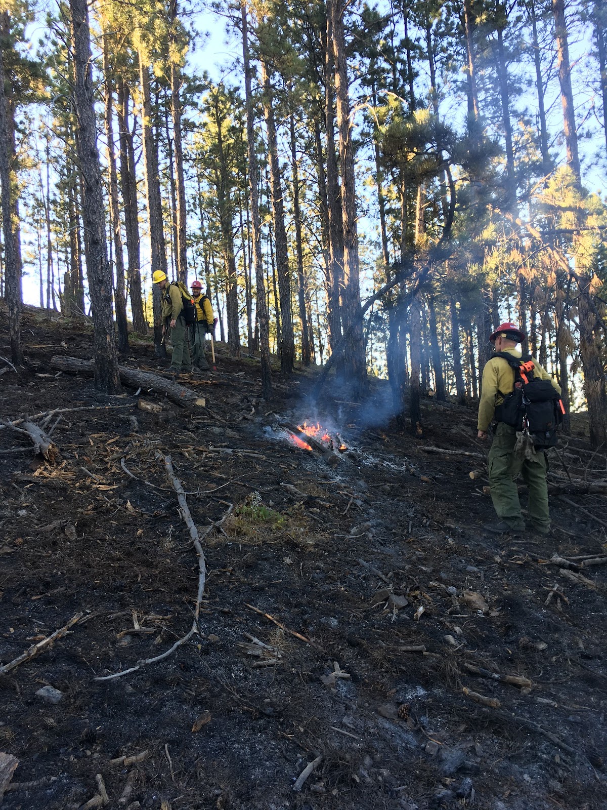
Boarding fire (4:39 pm)
  • Location: 1 mile northwest of north boat launch of Pactola Reservoir, South Dakota (Pennington County) 
  • Size: 0.1 acres
  • Resources: State responding 
  • Cause: lightning
  • Controlled as of 2:36 pm
Chopper fire (4:14 pm)
  • Location: 2.3 miles northwest of Crazy Horse Memorial, South Dakota (Pennington County) 
  • Size: 0.1 acres
  • Cause: lightning
  • Contained as of 11:51 pm
Shank fire (2:23 pm)
  • Location: 6 miles south of Teepee Work Center, South Dakota (Custer County) 
  • Size: 0.1 acres
  • Resources: State responding
  • Cause: lightning
  • Controlled as of 4:43 pm
South Fork fire (2:20 pm)
  • Location: 3 miles southwest of Deerfield Lake, South Dakota (Pennington County) 
  • Size: 0.1 acres
  • Resources: Federal responding
  • Cause: lightning
  • Contained as of 5:30 pm 
Pass Creek Well (#3) fire (1:48 pm)
  • Location: 3.5 miles east of Dewey, South Dakota (Near Pass Creek Well, Custer County)
  • Size: 33 acres
  • Resources: Federal and State responding
  • Contained as of 12:47 pm
Big Spring (#2) fire (12:45 pm)
  • Location: 1 mile southeast of Crow Peak, South Dakota (Lawrence County)
  • Size: 0.1 acres
  • Resources: Federal responding
  • Cause: lightning
  • Controlled as of 6:30 pm
Windmill fire (8:55 am)
  • Location: North of Jewel Cave, South Dakota (Windmill Draw area, Custer County)
  • Size: 0.1 acres
  • Resources: Federal and State responding
  • Cause: lightning
  • Controlled as of 2:33 pm

Sunday, September 4, 2016

September 4, 2016

Updates as of Monday, September 5

Picnic fire (6:30 pm)
  • Location: Sheridan Lake Road, South Dakota
  • Size: 0.1 acres
  • Resources: Federal responding
  • Cause: lightning
  • Contained/Controlled as of 8:12 pm
Hunter (#9) fire (5:27 pm)
  • Location: southwest of Crawford, Nebraska (Dawes County)
  • Size: 0.1 acres
  • Resources: Federal responding
  • Cause: lightning
  • Contained/Controlled/Out as of 6:30 pm
Interior fire (4:00 pm)
  • Location: 2.2 miles southeast of Interior, South Dakota (Pennington County)
  • Size: 1.42 acres
  • Cause: lightning
  • Contained as of 4:30 pm
Burlington Dam (#6) fire (2:29 pm)
  • Location: 6 miles north of Edgemont, South Dakota (Burlington Dam area, Fall River County)
  • Size: 0.1 acres
  • Resources: Federal and State responding
  • Cause: lightning
  • Contained as of 3:45 pm & Controlled as of 4:53 pm
White (#5) fire (1:16 pm)
  • Location: 5 miles west of Rochford, South Dakota (Near Whitetail Peak, Pennington County)
  • Size: 0.1 acres
  • Resources: Federal and VFD responding
  • Cause: lightning
  • Contained/Controlled as of 6:18 pm
Coffee Flats (#4) fire (1:16 pm)
  • Location: 9 miles southwest of Edgemont, South Dakota
  • Size: 195 acres 
  • Resources: Federal and VFD responding
  • Cause: lightning
  • Contained as of 3:47 pm
Haven fire (12:21 pm)
  • Location: 5 miles northeast of Pringle, South Dakota (2.5 miles southeast of Cicero Peak, Custer County)
  • Size: .4 acres
  • Resources: Federal, State, & VFD responding
  • Cause: lightning
  • Contained as of 9:55 pm
Booms fire (11:47 am)
  • Location: 8 miles northwest of Hot Springs, South Dakota (Near Brooms Canyon, Fall River County)
  • Size: 0.35 acres
  • Resources: Federal responding
  • Cause: lightning
  • Contained at 1:45pm
Krusee fire (9:07 am)
  • Location: 6 miles northwest of Sundance, Wyoming (Near Bear Den Canyon off Miller Creek Road)
  • Size: 0.1 acres
  • Resources: Federal responding
  • Cause: lightning
  • Contained at 10:30am

September 3, 2016

Power Pole fire (7:06 pm)
  • Location: 1 mile south of Pringle, South Dakota
  • Size: 0.1 acres
  • Resources: Federal & VFD responding
  • Cause: Lightning
  • Contained & Controlled as of 7:57 pm