Monday, March 20, 2017

March 20, 2017

Soldier Fire
  • Reported at 12:30 am
  • Located near Highway 34 and Old Stone Road in the Ft. Meade area
  • 2.6 acres
  • State resources responded
  • Contained at 1:00 pm and controlled at 1:30 pm
  • Human caused
Larvie Fire
  • Located north of Hot Springs
  • .1 acres
  • State and local resources responded
  • Started on private land; now burning in grass and timber litter
  • Human caused

Thursday, March 16, 2017

March 16, 2017

Fox Fire
  • Reported at 12:35 pm
  • Located in Nebraska, southeast of Ardmore
  • Started on private land and moved into Nebraska National Forest
  • 4.5 total acres; 3.2 acres on forest land
  • local and federal resources responded

Tuesday, March 14, 2017

March 14, 2017

Wrinkle Fire
  • Located west of Mt. Rushmore on Forest Service land
  • .10 acres
  • Caused by an abandoned campfire
  • controlled at 1:30 pm

Wednesday, March 8, 2017

Whitetail Fire

    March 10, 2017
    12:00 p.m.                        

    White Tail Fire

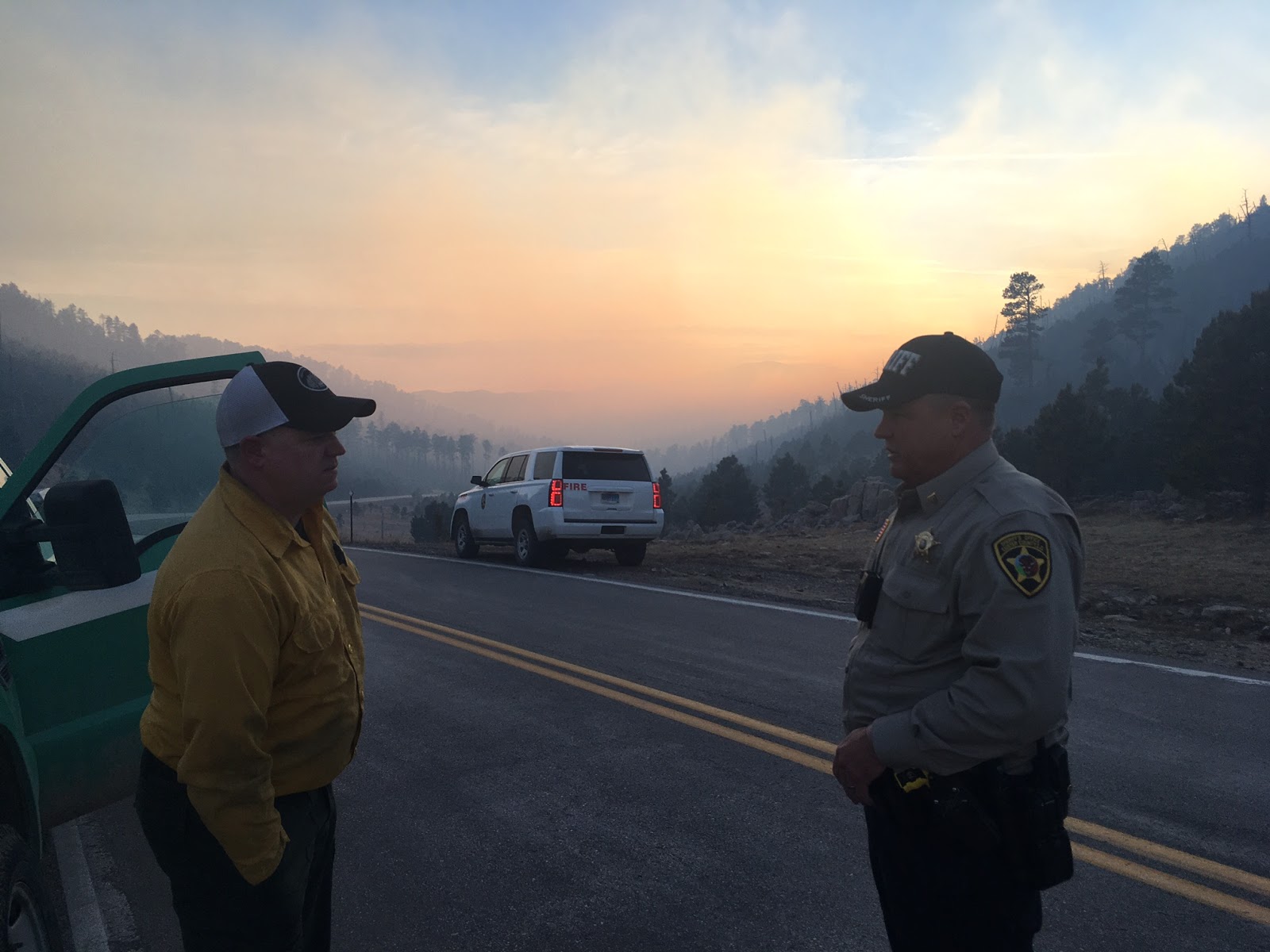
    Custer, SD - The Type 3 Incident Management team managing the White Tail Fire will transition to the local unit led by a Type 4 Incident Commander at 4:00 p.m. today.


    Aided by cooler temperatures and light snow overnight, the White Tail Fire is now 70% contained and 249 acres.  The fire will be 100% contained by 4:00 p.m.


    No structures have been lost and 60 personnel remain on site.


    Today, crews are continuing to strengthen containment lines and work to ensure hot spots along the perimeter are extinguished. It has been estimated that around 230 fence posts have been burned; crews are working on repairing the fences to keep buffalo in Custer State Park. Crews will be released tonight.  


    Highway 87 from Blue Bell Lodge to the intersection at Hwy 16A will be re-opened today, March 10, at 4:00 p.m.


    Smoke will remain visible for the next several days as isolated and heavy fuels continue to smolder within the perimeter of White Tail fire.


    Fire Statistics

    Start Date: March 8, 2017

    Size: 249 acres

    Containment: 70%

    Location: 6 miles southeast of Custer, SD

    Cause: Tree fell on power line

    Total Personnel: 60 personnel remain on scene


    March 9, 2017


    4:00 PM


    White Tail Fire


    Custer, SD – The White Tail Fire, located near Lower French Creek in Custer County started on Wednesday, March 8, 2017 and continues to burn in rugged terrain. The fire is 249 acres.

    A Type 3 Incident Management Team is managing the fire.

    Crews conducted successful burnout operations today and continue to secure the edges around the fire. At 3 p.m. today, the fire was 60% contained. Crews continue to extinguish and remove burning material near lines and fell snags.

    Resources will remain on scene overnight.

    Highway 87 from Blue Bell Lodge to the intersection at Hwy 16A remains closed.

    As isolated and heavy fuels continue to smolder within the perimeter of White Tail fire, smoke will remain visible for the next several days.

    The public is reminded to use caution when traveling in the vicinity of the fire area as there is heavy fire traffic on French Creek Road.


    • Located off Whitetail Rd near Lower French Creek in Custer County
    • 30+ acres 100-150 acres
    • State and Federal resources, dozer, ANG, volunteer Fire departments and SD DOT with air attack platform all on scene
    • Cause is under investigation 
    • Type 3 team in place
    • Burning on Custer State Park, Forest land and private land; majority of fire in Custer State Park
    • Started from outside of Custer State Park and moved in
    • Direct attack is difficult because of terrain
    • Resources on scene will be staying overnight
    • Hwy 87 from Blue Bell Lodge to the intersection at Hwy 16A is closed 
    • Expect heavy fire traffic on Lower French Creek Rd
    • Cause has been determined to be a tree that fell onto a power line
    Command post is located at the Hazelrodt Campground East of Custer
    
    source: www.wildfiretoday.com

    Photo by Jaime Haueter

    Photo by Jaime Haueter
    Photo by Mark Menning, SD Wildland Fire


    Photo by Mark Menning, SD Wildland Fire

    Photo by Mark Menning, SD Wildland Fire


      Crews prepping line for burnout
      Photo Credit: Brandy Peterson, SD Wildland Fire


      Aerial view of Whitetail Fire
      Photo Credit: SD Department of Transportation & Jared Hohn, Black Hills National Forest

      Photo by Jim Strain, SD Wildland Fire
      Photo by Jim Strain, SD Wildland Fire
      Photo by Jim Strain, SD Wildland Fire
      Photo by Jim Strain, SD Wildland Fire
      Photo by Jim Strain, SD Wildland Fire

      Aerial view of Whitetail Fire
      Photo Credit: SD Department of Transportation & Jared Hohn, Black Hills National Forest


      Aerial view of Whitetail Fire
      Photo Credit: SD Department of Transportation & Jared Hohn, Black Hills National Forest
      Aerial view of Whitetail Fire
      Photo Credit: SD Department of Transportation & Jared Hohn, Black Hills National Forest
      Aerial view of Whitetail Fire
      Photo Credit: SD Department of Transportation & Jared Hohn, Black Hills National Forest
      

      Tuesday, March 7, 2017

      March 7, 2017

      Thunderhead Falls

      • Located on Thunderhead Falls Road, near French Drive
      • .1 acres
      • Caused by downed power line
      Lakota
      • Located between Hermosa and Hayward, Highway 40
      • Federal and State engines en route 
      • .25 acres

      Saturday, March 4, 2017

      Wolf Fire

      Wolf Fire
      • Large Grass fire
      • MM 112 North of Wall
      • several County VFD Nebraska Grasslands engines on Scene
      • 50% contained  70% contained 100% contained
      • 7,000 acres  5,000 acres
      • City of Quinn is threatened. Quinn and structures are no longer threatened
      • Engines will be on scene through the night
      • Red flag warning on Sunday, March 5th
      For media interviews, go to the incident command post in Quinn next to the post office

      U.S. Forest Service – News Release
      Nebraska National Forests & Grasslands · 125 N. Main Street · Chadron, NE ·

      FOR IMMEDIATE RELEASE:  March 4, 2017
      Contact:  Kurt Pindel, Wall District Ranger (605) 279-2126, Ext. 203  
      High Fire Weather Expected Tomorrow; Wolf Fire 70% Contained
      Wall, SD – The Wolf Fire started late this morning two miles east of Wall, then quickly burned northward and reached an approximate size of 5,000 acres before firefighters secured 70% containment by 5:00 PM today. 

      A unified command responded from the Wall Volunteer Fire Department (VFD), Pennington County and the US Forest Service, Nebraska National Forests & Grasslands (NNFG). Firefighter efforts successfully removed early threats to the community of Quinn and several structures. The fire was human caused.

      Kurt Pindel, Wall District Ranger said “Because of the great help from Pennington County and all the VFDs, we were fortunate to get ahead of this grass fire to protect Quinn and several structures. But folks need to be aware that high fire danger will continue for the next several days. We’d like to ask for everyone’s help to prevent wildland fires.”

      March 4, 2017

      Boundary Fire

      • Prescribed burn started in Crook County, Wyoming; crossed into South Dakota, south of I-90
      • 6.5 acres (4.5 acres on SD side); forward progress has stopped 
      • Forest service, VFD and SD State engines on scene
      • Controlled
      Oak Fire
      • Contained and controlled 
      • .10 Acres adjacent 
      • White wood city limits
      • man caused
      • Controlled
      Wolf Fire

      Please check the Wolf Fire post for updates 

      Stanmark Fire
      • Man caused
      • Several VFD, BKF, and state resources on scene
      • Hand crew and Dozer are en route
      • Keystone
      • 2 acres 7 acres

      Iron Mt. Fire
      • BKF and State engine on scene
      • Man caused
      • Keystone
      • .5 acres
      • Controlled
      South Rockerville
      • State resources on scene
      • 9.9 acres 14.5 acres
      • Controlled
      Grizzly Bear
      • 3 acres 11.6 acres
      • Near Stanmark
      • Federal and state resources on scene
      • Located near Iron Mt. Rd
      • Controlled
      Grizzly Bear Fire
      Credit: Mark Menning