Monday, July 31, 2017

July 31st


Strawberry CA 1:29 pm
  • Location: 8 miles north of Hulett, WY
  • Size: 191 acres
  • Cause: human
  • Resources on scene
Devil's Canyon 3:45 pm
  • Location: east of Edgemont, 2 miles south of Flint Hill
  • Size:  8.75 acres
  • Cause: lightning
  • Resources on scene
Blowout CA 2:04 pm
  • Location: north of Oahe Dame
  • Size: .1 acres
  • Resources on scene

Sunday, July 30, 2017

July 30th

Irish 9:01 am
  • Abandoned campfire
Strawberry CA 1:29 pm
  • Located 8 miles north of Hulett, WY
  • Size: 191 acres
  • Human caused
  • Resources on scene
Devil's Canyon 3:43 pm
  • Located east of Edgemont, 2 miles south of Flint Hill
  • Size: 4 acres
  • Cause: lightning
  • Resources on scene
  • 75% contained

Tuesday, July 25, 2017

July 25, 2017

Mowree 12:34 pm
  • Location: South of Presho near White River
  • Size: 3.7 acres
Pine Glen 12:58 pm
  • Location: North of Ainsworth
  • Size: 5 acres

Monday, July 24, 2017

7/23/17 - 7/24/17

7/24/17

Chilson Wildfire 5:50 am
  • Location: 4 mi S of Minnekahta
  • Size: 10 acres 20 acres  40-50 acres 33.4 acres (7/25 update)
  • Resources on scene:
    • 4 engines
    • 3 hand crews
    • Type 3 helicopter
    • 1 SEAT
    • 2 Black Hawk Helicopters
  • Cause: unknown Lightning
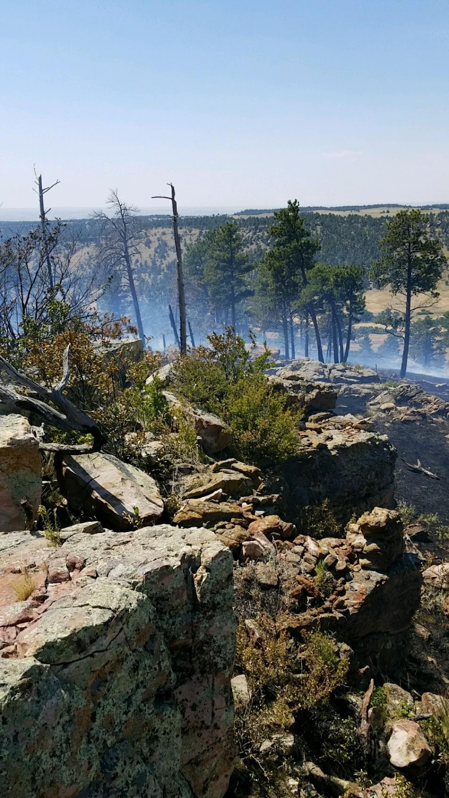
Photo Credit: Mark Menning, Black Hat Crew Boss

Photo Credit: Mark Menning, Black Hat Crew Boss

Photo Credit: Mark Menning, Black Hat Crew Boss
Boardinghouse  8:59 am
  •  Location: Black Buttes, Bearlodge in Wyoming 
  • Size: .1 acre
  • Cause: Lightning
  • Contained and controlled
Griggs 10:58 am
  • Location: Grigg's Gulch, Lawrence County, South of Crow Peak
  • Size: .25 acres  1 acre 1.5 acres
  • Resources on scene
  • Cause: Lightning
  • Contained
#4 False Alarm 11:14 am
  • Location: Spearfish Mountain 
#5 False Alarm 1:16 pm
 
Gooseberry  1:19 pm
  • Location: East of Summit Ridge 
  • Size: 1 acre 3 acres 3.17 acres
  • Controlled
  • Cause: Lightning
Spring Creek 2:59 pm
  •  Location: Crook County
  • Size: 2 acres
  • Contained at 8:00 pm
Burno 3:19 pm
  • Location: Spearfish Mountain
  • Size: 1 acre
  • Resources on scene
  • Cause: Lightning
  • Contained at 7:45 pm
#9 5:55 pm
  • Location: Crook County, WY
#10 7:46 pm
  • Location: Crook County, WY

7/23/17


Hylle Wildfire
  • Location: off Hazel Rod rd, approx. 1.5 miles SW of Stockade Lake, outside of Custer, SD
  • Size: 0.25 acres
  • Resources on scene
  • Contained and Controlled

Saturday, July 22, 2017

Saturday, July 22, 2017

Negabauer Wildfire
  • Location: Approx. 19 miles S of Edgemont, SD/near the SD/NE state line
  • Size: 36 acres (updated 7/23)
  • Resources on scene
  • There was a flair up on 7/23 which increased the size to 36 acres
  • No new containment since the flair up. There was original containment on the 22nd at 10pm.

Black Hill Wildfire 
  • Location: Approx. 4 miles SW of Cook Lake, WY on Forest Service land
  • Size: 1.91 acres
  • Resources on scene
  • Cause: Lightning
  • Controlled (updated 7/23)

Crow Wildfire 
  • Location: N of Crow Peak near Spearfish, SD
  • Size: 1.2 acres
  • Cause: Lightning
  • Contained

Friday, July 21, 2017

Friday, July 21, 2017

NOTE: Smoke drifts in the Black Hills area today are coming from the Lodgepole Complex fire along the Missouri River in Central Montana: https://inciweb.nwcg.gov/incident/5399/. 

For more information on smoke management, see: http://gpfireinfo.blogspot.com/p/smoke-management.html.


8 p.m.


Mahoney Wildfire
  • Location: Mahoney Draw, approx. 3.5 miles NW of Cook Lake in WY on county.
  • Size: 0.67 acre
  • Contained


Manly Wildfire
  • Location: Approx. 7 miles SW of Cook Lake in WY on county.
  • Size: 1 acre
  • Contained

209 Wildfire
  • Location: Off of Blacktail Rd,, approx. 4 miles West of Cook Lake in WY on county.
  • Size: 0.1 acre
  • Contained

Russel Wildfire
  • Location: Off of Blacktail Rd, approx. 6 miles East of Devil's Tower in WY on Forest Service land.
  • Size: 0.1 acre
  • Contained
Geis Wildfire
  • Location: Approx. 0.5 miles East of Gets Reservoir in WY on county
  • Size: 0.16 acre
  • Contained


4:30 p.m.

Sun Ridge Wildfire
  • A final update on the Sun Ridge Fire can be found here http://bit.ly/2uJ90kz (updated 7/22)
  • For more information on the Sun Ridge wildfire, contact Public Information Officer: Jim Bussell, 605-863-0061
  • Location: Approx. 1 mile west of Rapid City, off of Nemo Rd.
  • Size: 1.5 acres
  • 70% contained
  • Fire crews continue to put in and reinforce hand-line around the fire.
  • No structures threatened
  • Resources: Local, VFDs, Federal and State
  • Cause: unknown

3:40 p.m.

SourDough Wildfire
  • Location: Approx. 7 miles North of Hulett, WY in Crook County, WY on private
  • Size: 10 acres (updated 7/22)
  • Contained

Martin Wildfire
  • Location: 1 mi NE of Richardson Well, West of Pleasant Valley Rd. Approx. 17.5 miles SW of Custer, SD
  • Size: 8.25 acres (updated 7/22)
  • Resources on scene
Teddy Bear Wildfire
  • Location: Approx. 7.5 miles SW of Rochford, SD
  • Size: 0.1 acre
  • Cause: Unknown

Shaw Wildfire

  • Location: NE of Devils Tower/Northern Bearlodge on private
  • Size: 0.65 acres
  • Cause: Lightning
  • Contained at 3:15 p.m.


12:02 p.m.

Togus Wildfire
  • Location: 9 miles north of Sundance, WY
  • Size: 0.1 acre (single tree)
  • Cause: Lightning
  • Resources: Federal
  • Controlled

10:19 a.m.

Eden Wildfire
  • Location: NE of I-90 between Whitewood and Sturgis Remmington Pl on private
  • Size: 0.1 acre (single tree)
  • Cause: Lightning
  • Controlled

Thursday, July 20, 2017

Thursday July 20, 2017

Brownlee Wildfire 
Reported: 3:30 pm, July 19
Location: South of Valentine, NE
Size: 1 acre
Cause: Lightning
Contained

North 2 Wildfire
Reported: 11:33 pm, July 19
Location: 2 miles east of Halsey, NE
Size: 15 acres
Resources: state and local
Cause: Lightning
Contained

Big Canyon Wildfire 
Reported: 6:20 am, July 20
Location: 4 miles so. of Chadron, NE
Size: .1 acre
Resources: Federal and Local
Cause: Lightning